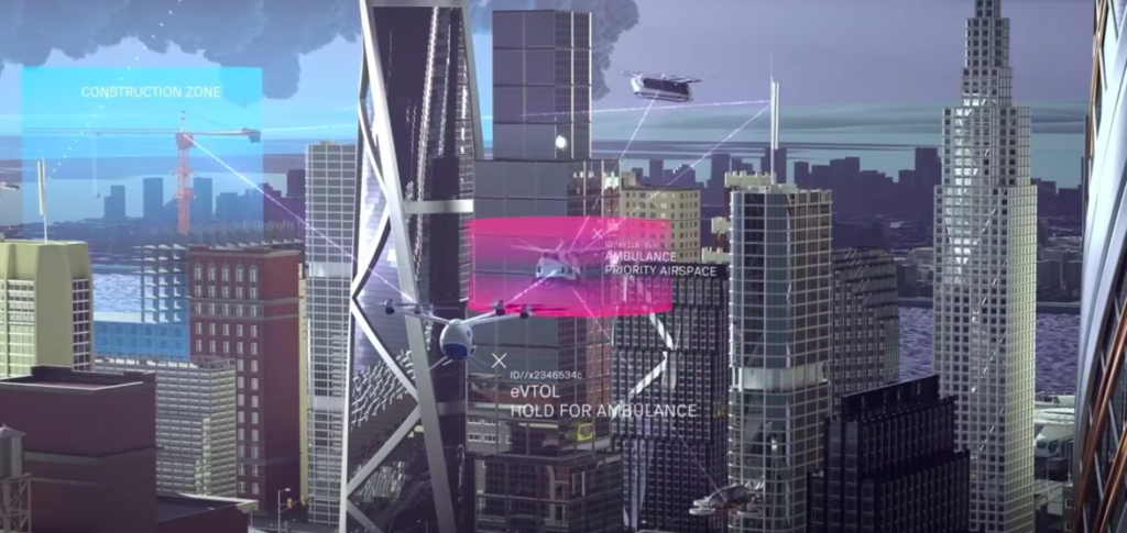
According to official information from NASA (*), this network of artificial intelligence – aimed at air taxis and drones – has a similar principle to that used by applications such as Google Maps, which combines data, maps, accident reports and traffic conditions to give the driver the opportunity to choose the best route for a given moment.
ADVERTISING
Such information will be updated in real time and the drone will have the ability to “make decisions for itself”, being able to divert the route if previously unforeseen objects or dangers appear along the way. ⤵️
Read also


(🇬🇧): content in English
(*): Content in other languages translated by Google Tradutor
(🚥): may require registration and/or subscription