“With this historical series of fire data, we can understand the effect of climate and human action on fires and forest fires”, says Ane Alencar, coordinator of MapBiomas Fogo and director of Science at the Amazon Environmental Research Institute (IPAM ).
ADVERTISING
Using images generated by three Landsat satellites, the action of fire was tracked across all types of land use and coverage in Brazilian territory. According to the results, the Cerrado and the Amazon were the most affected biomes, corresponding to around 86% of the burned area.
O Cerrado it burned an average of 7,9 million hectares/year, that is, an area equivalent to the territory of Scotland each year. In the case of Amazon, the average was 6,8 million hectares/year. When analyzing the proportions of areas affected within biomes, the Pantanal was most affected: 51% of its territory was consumed by fire during that period.
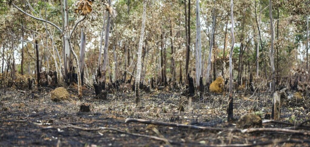
Roof impacted by fire
According to the analysis, more than two thirds (68,9%) of the fires and fires occurred in native vegetation, although the proportion varies between biomes. Fields and savannas, for example, are the most affected types of native vegetation, while the Amazon and Atlantic forest showed a higher incidence of fire in anthropic areas, that is, areas altered by humans, such as pasture areas.
ADVERTISING
Mato Grosso was the state with the highest occurrence of fires in the period analyzed, followed by Pará and Maranhão. The municipalities that burned the most in the country were Corumbá (MS), São Félix do Xingu (PA) and Formosa do Rio Preto (BA). According to Ane, fire is not always undesirable.
“Fire is only bad when it is used inappropriately and in biomes that do not depend on fire to survive, such as the Amazon. In biomes such as the Cerrado, the Pantanal and the Pampa, fire has an ecological role and must be managed correctly to avoid becoming an agent of destruction”, explains the expert.
Frequency and intensity
Although it is natural in some ecosystems, data shows that the frequency and intensity of fires have increased in recent years, due to deforestation and climate change, which affect temperatures and intensify dry periods.
ADVERTISING
“For this, practices related to Integrated Fire Management (MIF) are important, as they can, through prescribed and controlled burning, reduce the amount of combustible material and avoid large fires”, says Ane.
The complete mapping data can be accessed free of charge on the MapBiomes, an organization that brings together universities, NGOs and technology companies.
The study also provides sections by frequency, biome, state, municipality, river basin, conservation unit, indigenous land, settlements and areas with a Rural Environmental Registry (CAR). This registry is a mandatory public record for all rural properties and gathers information for environmental and economic planning and the fight against deforestation.
ADVERTISING
(With Brazil Agency)
Read also


* The text of this article was partially generated by artificial intelligence tools, state-of-the-art language models that assist in the preparation, review, translation and summarization of texts. Text entries were created by the Curto News and responses from AI tools were used to improve the final content.
It is important to highlight that AI tools are just tools, and the final responsibility for the published content lies with the Curto News. By using these tools responsibly and ethically, our objective is to expand communication possibilities and democratize access to quality information. 🤖